Quick Labeling
The EO Time Series Viewer assists you in describing, i.e. label reference data, e.g. by describing vector geometries with a related land cover type or observed events. Whether your locations (point, lines or polygons) of interest already exist, or need to be digitized on the visualized maps, in both cases you want to describe them in the attribute table of the vector layer.
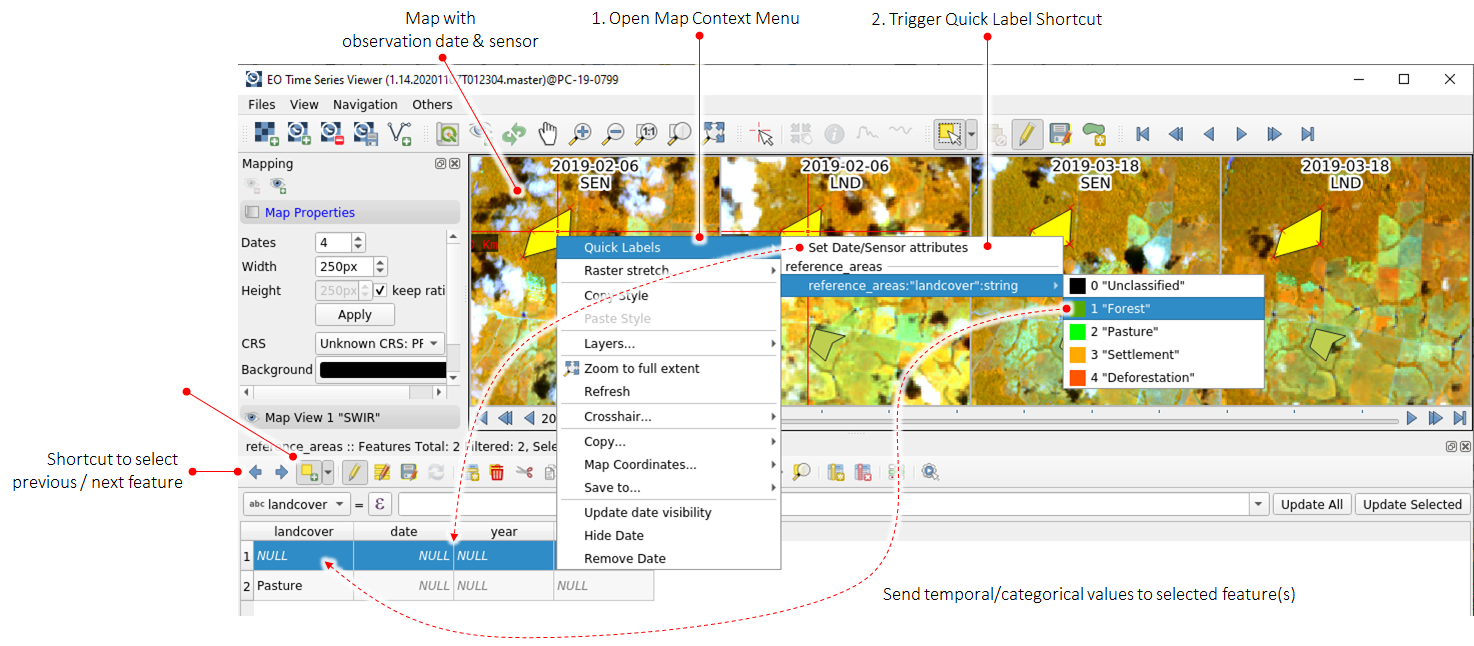
The EO Time Series Viewer supports this with “Quick Label” short-cuts from the map context menu. If triggered, they send temporal or categorical information direct to the attribute cells of selected geometries, e.g a polygon that has been selected in a map.
Let’s assume we have a map related to a Landsat (LND) observation taken at 2019-02-05T11:23:42.00. The following table shows how this is translated into linked vector fields:
Type of linked vector layer field |
||||||||
|---|---|---|---|---|---|---|---|---|
LabelType |
varchar |
int |
double |
datetime |
date |
time |
bool |
blob |
Date |
2019-02-05 |
2019-02-05T00:00:00 |
2019-02-05 |
|||||
Date-Time |
2019-02-05T11:23:42 |
2019-02-05T11:23:42 |
2019-02-05 |
|||||
Time |
11:23:42 |
2019-02-05T11:23:42 |
11:23:42 |
|||||
Day of Year (DOY) |
36 |
36 |
36 |
|||||
Year |
2019 |
2019 |
2019-02-05T11:23:42 |
2019-02-05 |
11:23:42 |
|||
Decimal Year |
2019.0980926430518 |
2019 |
2019.098 |
|||||
Sensor Name |
LND |
|||||||
Source Image |
/path/to/image |
|||||||
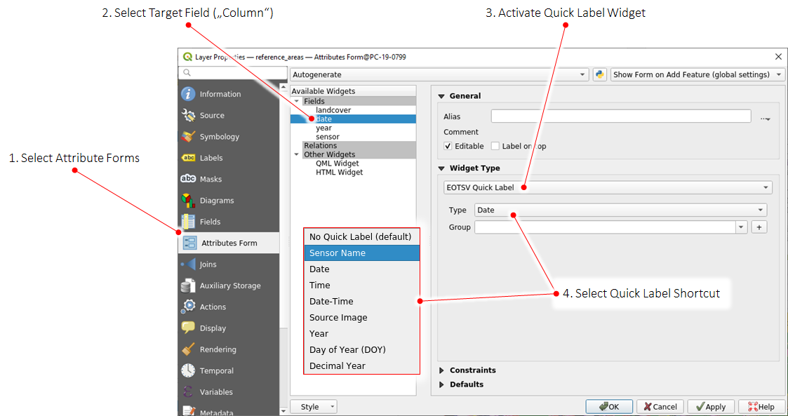
To use Quick Labels, open the vector layer properties and activate them in the Attribute Form widget: